From: Glacier National Park, Montana (USA)
To: Banff National Park, Alberta (Canada)
Distance: 260 mi (418 km)
Travel time w/brks: 6 hr 59
Distance since start: 3,285 mi (5,282 km)
Day 9 - Banff National Park, Alberta (Canada)
| Travel From: Glacier National Park, Montana (USA) To: Banff National Park, Alberta (Canada) Distance: 260 mi (418 km) Travel time w/brks: 6 hr 59 Distance since start: 3,285 mi (5,282 km) |
|
Thursday 6/29/2006
One of the issues we have not yet worked out is how to get a good morning alarm setup when we are boon docking. So far, we've relied on setting an alarm with the cell-phone. This morning we wanted to get up early enough that we could enjoy the sunrise. Isabella set the alarm at 5am. But when nobody got up, she decided we should sleep a bit longer. Only problem was that not everybody heard the alarm. We finally got up at around 5:30am. The view of the mountains from the campground was very nice. There was a golden shadow cast over the mountains. We took off from the campsite and headed slowly up towards Logan Pass again, stopping along the way. We had a bit of overcast so the colors were not as pronounced. We took a few pictures and then turned around back towards the campsite.
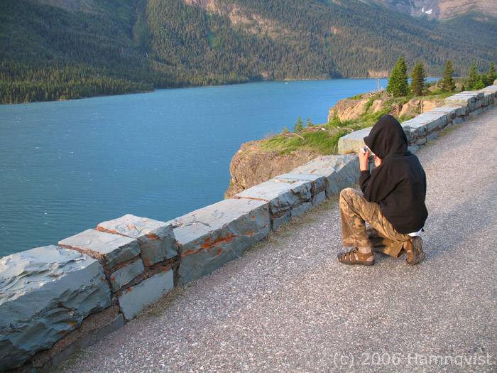
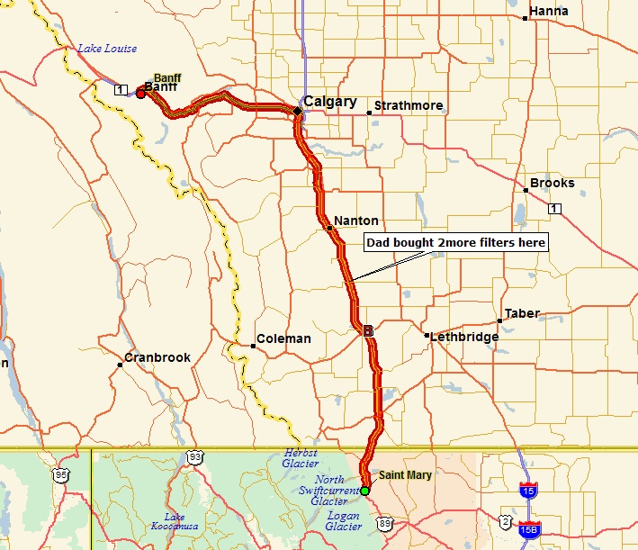
Erik is trying to capture a panorama of St Mary Lake in Glacier NP
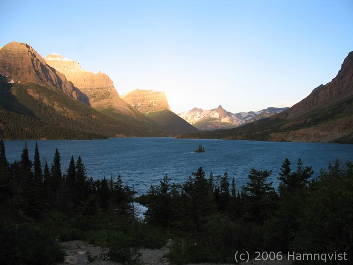
A view of St Mary Lake at Glacier NP very early in the morning
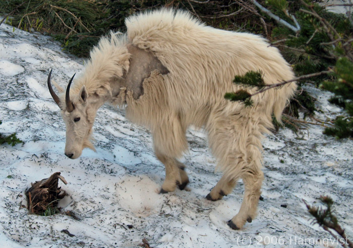
We bumped into several mountain goats near Logan pass in Glacier NP. They are shedding their coats right now.
While we hooked up Isabella, prepared sandwiches for the road-trip towards Banff. By about 8:30am we were on the road from St Mary towards the Canadian border. The road north from St Mary is much better than the road we used coming in. We hit the border in about 30 minutes. As we pulled into the line at the border checkpoint, we saw another Airstream ahead of us. We called them on channel 14 of the CB (common channel for Airstreamers). Turns out they were from Pennsylvania and heading north to Banff as well and eventually to join the Airstream Caravan we had skipped out of. I thought we would be on the road behind them in no time, but we ended up being pulled aside for more paperwork scrutiny. It probably cost us about 40 minutes. After we were finally done in one of their offices, we handed the "Admitted" paper back to the immigration lady that had first flagged us for inspection. She looked disappointed that we were admitted. Either way, we got on the way quickly. We were now in Canadian province of Alberta.
The road north was easy and generally flat. We were heading towards Calgary. We went through a few small towns. The landscape was predominantly farming. We stopped in Chrisholm, where I picked up a two more fuel filters -- does not hurt to be prepared after what we have been through! When we finally approached Calgary it was evident that it was a much bigger city than the map suggested. Our Street Atlas USA is of limited help here in Canada. Many of the roads just show up as "Unknown". As we approached from the south along route 2 there was a sign for a split of route 2, both going to Calgary. We took the left side of the fork. This turned out to be a huge mistake!
We ended up in a continuous stream of red lights and tight traffic. After about 1/2 hour of this stop-and-go we have not yet gotten into the city. We realized that Street Atlas USA proposed a route through Calgary that was completely horrible, especially with a 31ft trailer. We tried to navigate around it but it was like quicksand, we got deeper and deeper into it. We eventually got into downtown of Calgary. And then, to top it off, the GPS lost signal when we travelled between the 50+ story sky scrapers. We criss crossed back and forth, trying to dodge side walks, yielding to people crossing the road without paying attention, restricted lanes, road constructions, cars cutting us off, very tight underpasses, one way streets and people who looked at us like we were from Mars. And the "roads" in Street Atlas appeared right over the river!!! We finally struck Gold and got onto a narrow road which turned out to be Trans Alaskan Highway. It was a real miracle that we did not dent the trailer or possibly damage a tire against a sharp sidewalk.
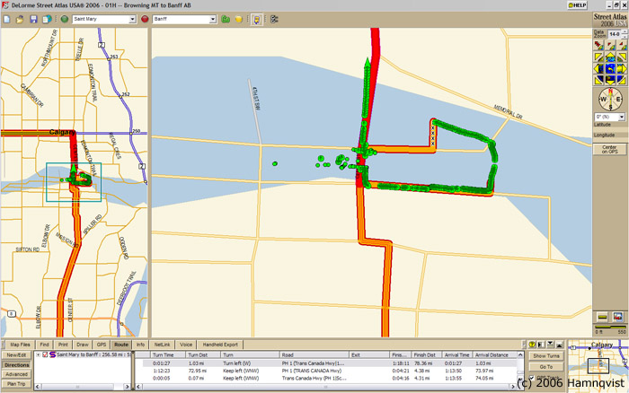
A small fraction of our pain: tracking dots everywhere -- our GPS gets confused between skyscrapers in downtown Calgary ..
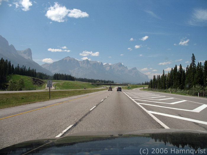
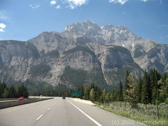
Banff is not far from Calgary. Only about one hour or so. The weather was great. The approach was spectacular. This was such a relief after the pain we had going through Calgary. We bought a one year pass, since we were going to stop in Jasper after this as well. The mountains are quite something as you approach Banff. We checked into the Tunnel Mountain campground and got a spot with a great view.
Approaching Banff National Park in Alberta, Canada
Taking our exit for Tunnel Mountain in Banff
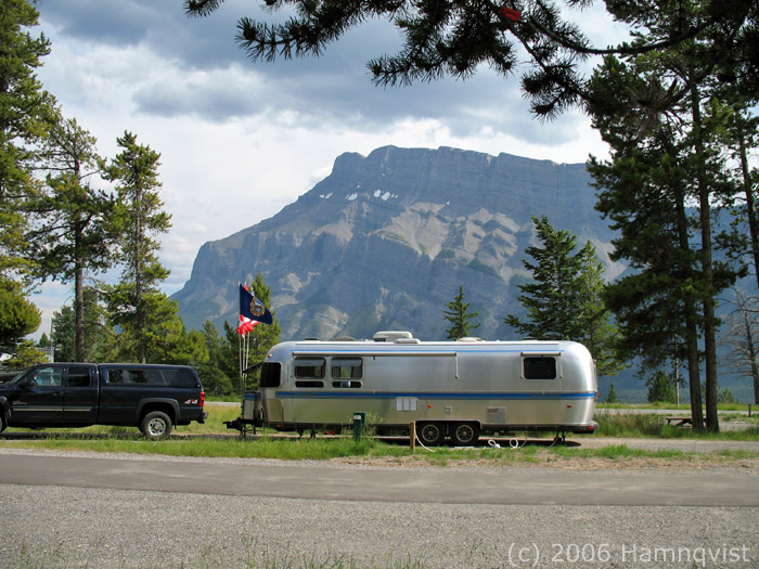
Spectacular views: our campsite at Tunnel Mountain in Banff
Shortly after we checked in we got back out for a quick tour of the city. We stopped and walked the path by the river. The town itself is quite nice. Clearly a town for affluent people. It is surrounded by tall mountains. We also visited a water fall just outside of town. The river looks glacial (cold green blue). We also made a quick stop at the tourist information to collect information about what to do tomorrow. When we got back, Erik prepared dinner: Pasta with meat sauce that Lilli had cooked at home. It tasted great.
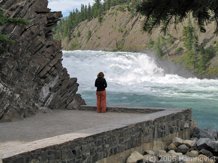
Isabella checks out a big waterfall in Banff

Our campsite is full of life: Columbian Ground Squirrels everywhere
| Campground Name: Tunnel Mountain (hookup), Banff Our hookups: 30 Amp, Water and Sewer (site 241) WiFi: No GSM service: Yes, four bars TV Channels: No cable Cost: $36/night Reservation mode: Canada's national parks web site |
 |
[Next day] [Previous Day] [Main] [Summary]
All Pictures (c) 2006 Hamnqvist, Background features the morning mountain side, outside of our campsite at Glacier NP.